
Beware.
By Frank Landymore
Published May 20, 2026 1:22 PM EDT
Add Futurism(opens in a new tab)More information
 Getty / Futurism
Sign up to see the future, today
Can’t-miss innovations from the bleeding edge of science and tech
Email addressSign Up
It’s never a good sign when meteorologists start throwing around phrases like “double whammy.” But that’s what scientists at the National Oceanic and Atmospheric Association say we’re in for with the return of El Niño, the fearsome tropical climate pattern.
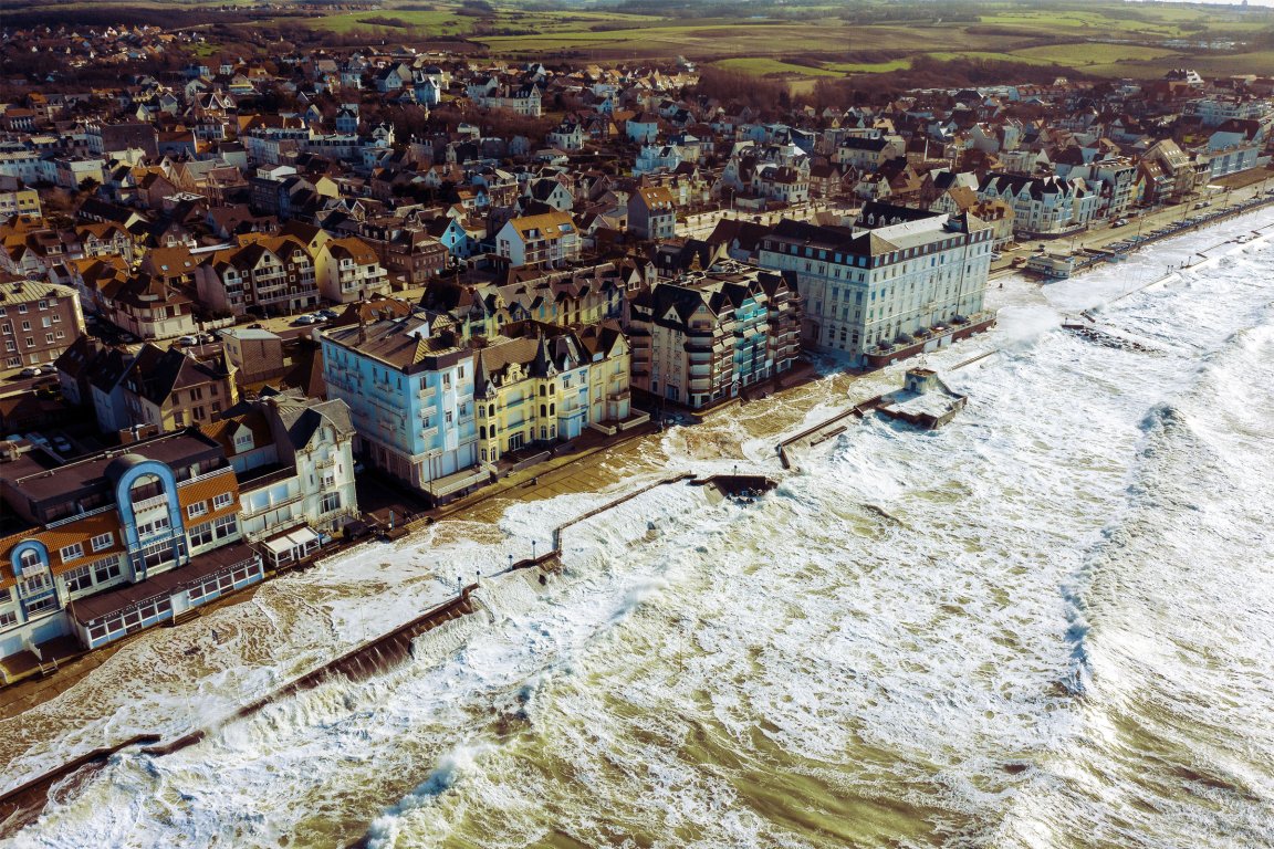
In a new announcement, NOAA’s National Weather Service said that it was predicting El Niño will likely emerge in July and last through the winter, bringing high-tide flooding with it. These floods can happen without storms or heavy rainfall; as El Niño causes flux in the jet streams above the ocean, these can elevate local sea levels along the coasts and spill over onto land.
William Sweet, a NOAA oceanographer and high tide flooding expert, warns that these events often end up being a “double whammy,” amid a backdrop of climate change.
“The first punch is decades of sea level rise, which has waters close to the brim in many coastal communities,” Sweet explained in a statement. “And now with this second punch — a strong El Niño — coastal communities face more frequent, deeper and widespread high tide flooding along both the West and East Coasts.”
El Niño is part of a cyclical climate phenomenon caused by shifting winds and surface temperatures over the ocean. In the phenomenon’s warm phase, the planet’s easterly winds along the equator, called trade winds, weaken and migrate upward, warming the northern oceans. In its cool phase, El Niña, the opposite happens: the trade winds get stronger and cool the Pacific off the western Americas and drive warmer waters towards Asia. It swings between warm and cool phases every two to seven years on an irregular schedule, wreaking varying degrees of devastation.
This year, unfortunately, is anticipated to be historically disastrous. Scientists are projecting that El Niño will heat sea surface temperatures in the eastern tropical Pacific by 5.4 degrees Fahrenheit. Experts say a similar shift happened during the strongest El Niño on record in 1877 to 1878, which drove a global famine that killed more than 50 million people worldwide.
While the food supply chains are more robust than it was 150 years ago — or so you’d hope — that figure gives you an idea of how disruptive a few degrees’ difference in ocean temperatures can be. Batten down the hatches, folks.
More on the climate: The Upcoming El Niño Is About to Unleash Devastation, Experts Warn
Frank Landymore
Contributing Writer
I’m a tech and science correspondent for Futurism, where I’m particularly interested in astrophysics, the business and ethics of artificial intelligence and automation, and the environment.